When it comes to property ownership or development, few professionals are as essential as a land surveyor. Whether you’re building a new home, subdividing land, or resolving a boundary dispute, accurate land measurements are critical to ensure that every project stays legally compliant and structurally sound.
This guide explains what a land surveyor does, why their work is so important, and when you might need one for your Sydney property.
Also Read: Power of Communication: Family Lawyers Gold Coast on Amicable Resolutions
The Role of a Land Surveyor
A land surveyor’s primary job is to measure, map, and determine the exact boundaries of a parcel of land. Using advanced technology and precise instruments, surveyors establish property lines and create detailed plans that form the foundation of legal titles, construction layouts, and development projects.
In Sydney, land surveyors often collaborate with architects, engineers, and builders to provide the spatial data necessary for design, planning, and construction approvals. Their expertise ensures that developments are built in the right place — and on the right side of the boundary.
Key Types of Land Surveys
Depending on your project, different types of surveys may be required:
Boundary Survey
Defines and marks the legal property lines. This is essential for ownership verification, fencing, and resolving boundary disputes.
Detail & Contour Survey
Maps the natural and built features of a site, including elevations, vegetation, and existing structures. Commonly used for architectural and engineering design.
Subdivision Survey
Used when dividing a single parcel into multiple lots. Surveyors prepare plans that comply with NSW subdivision laws and local council requirements.
Construction Set-Out Survey
Ensures that buildings, roads, and utilities are positioned according to approved plans before construction begins.
Identification Survey
Verifies if existing buildings or structures are positioned correctly within legal boundaries, often required for sales, refinancing, or development approval.
Why You Might Need a Land Surveyor in Sydney
There are many occasions when engaging a land surveyor becomes necessary, such as:
- Buying or selling property: Confirming boundary accuracy before settlement.
- Building a home or fence: Ensuring structures are positioned within property limits.
- Subdividing land: Preparing certified subdivision plans for NSW Land Registry Services.
- Lodging a development application (DA): Most Sydney councils require survey data for approval.
- Resolving neighbour disputes: Clarifying boundary positions to prevent or settle disagreements.
If you’re planning any of these activities, professional surveyors Sydney can help you determine precise boundary locations and prepare the required documentation to meet council and legal standards.
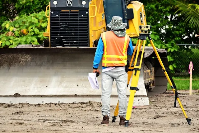
Tools & Technology Used in Modern Surveying
Modern surveying has evolved far beyond tape measures and compasses. Today’s surveyors rely on:
- GPS and GNSS equipment for real-time positioning
- Total stations and laser scanners for millimetre-level accuracy
- Drones (UAVs) for large-scale mapping and aerial imaging
- 3D modelling and CAD software for detailed visualisation and data sharing
These tools enable faster, safer, and more reliable surveying — even in complex urban environments like Sydney.
The Importance of Using a Registered Surveyor
In New South Wales, only a Registered Surveyor (licensed under the Board of Surveying and Spatial Information, or BOSSI) can legally certify surveys for land ownership, subdivision, or boundary marking.
Using a registered professional ensures that your survey complies with NSW legislation and that your property boundaries are accurately recorded on official plans.
CitiSurv’s team of fully certified and registered surveyors combines local expertise with the latest technology to deliver reliable, high-accuracy results across Sydney and beyond.
How to Choose the Right Land Surveyor
When selecting a surveyor, consider the following factors:
- Registration & licensing: Verify their credentials with BOSSI NSW.
- Local experience: Familiarity with Sydney councils and regulations.
- Transparent pricing: Request clear, upfront quotes.
- Client reputation: Look for consistent positive reviews and testimonials.
- Communication: Choose professionals who explain the process clearly and keep you informed.
Frequently Asked Questions
How much does a land survey cost in Sydney?
Typical residential boundary surveys start from around $800–$1,500, depending on site complexity and location.
How long does a survey take?
Most surveys can be completed within one to three days, though larger developments may take longer.
Do I need council approval for a survey?
The survey itself doesn’t require approval, but most development applications in Sydney do require a certified survey plan.
In Summary
A professional land surveyor plays an indispensable role in every stage of property ownership and development. From defining precise boundaries to supporting council submissions and construction plans, their expertise ensures that every square metre of land is accurately accounted for.
If you’re planning to build, subdivide, or resolve a boundary issue, get in touch with CitiSurv, Sydney’s trusted team of registered land surveyors, for reliable, compliant, and precise surveying services.